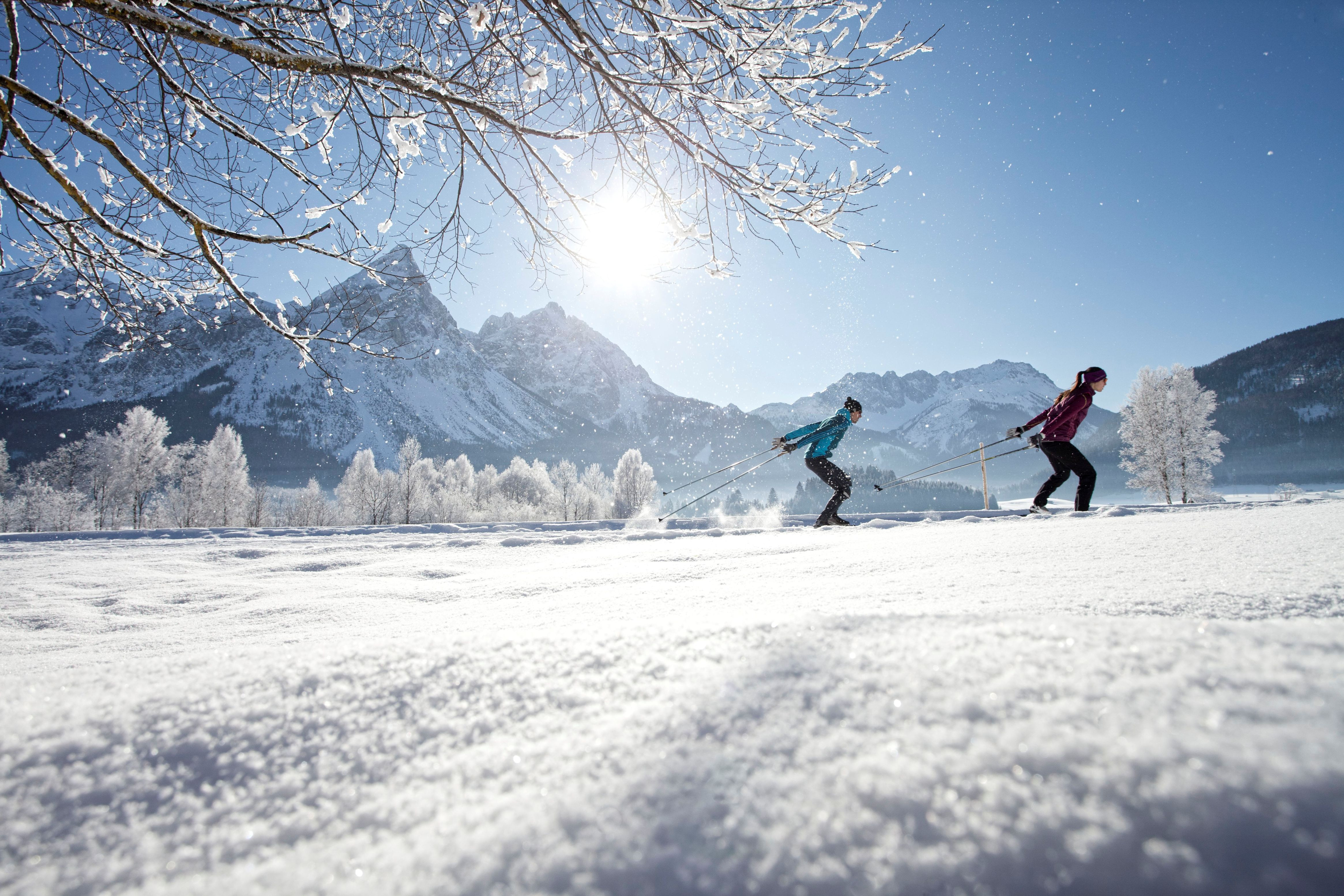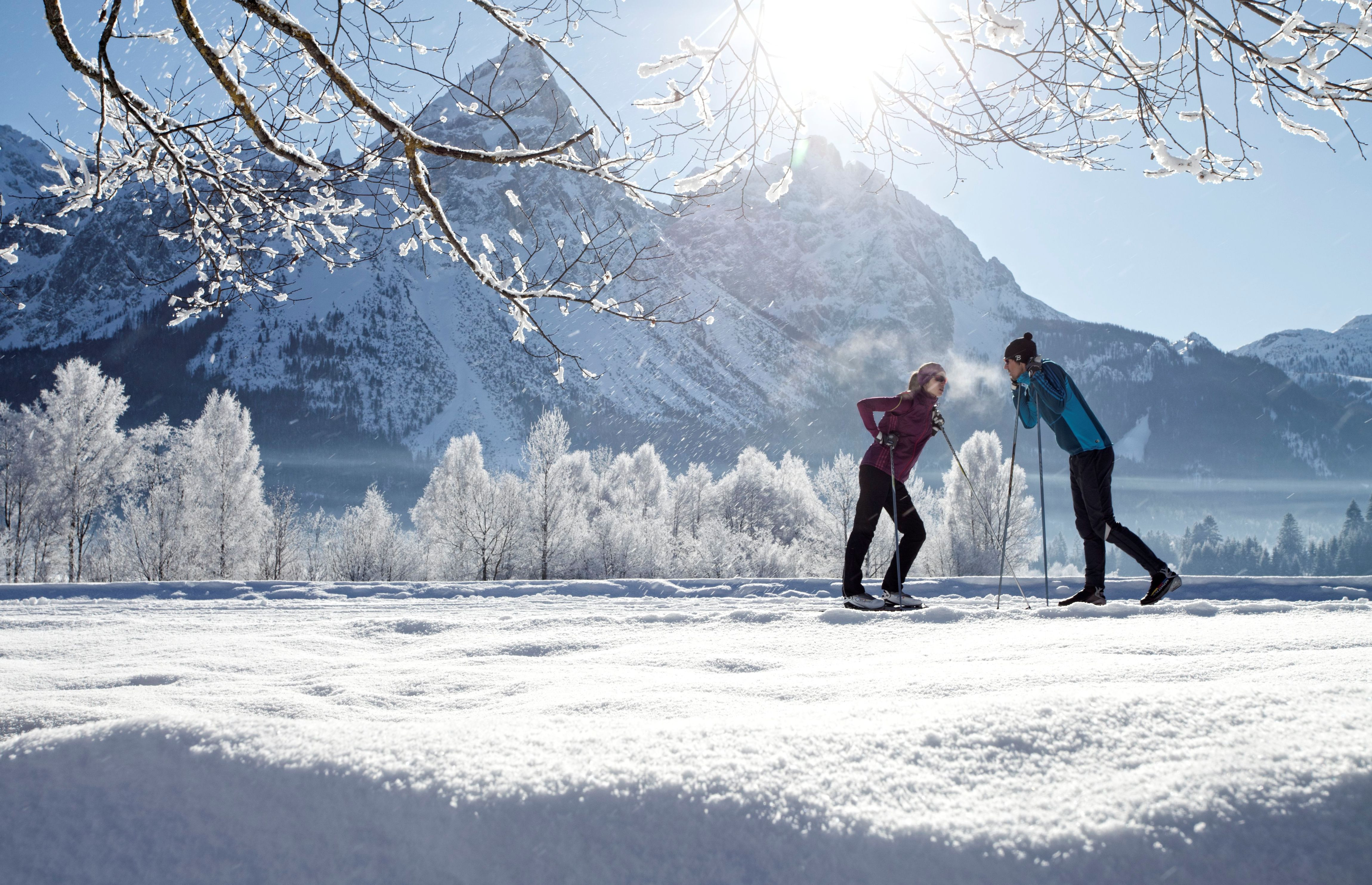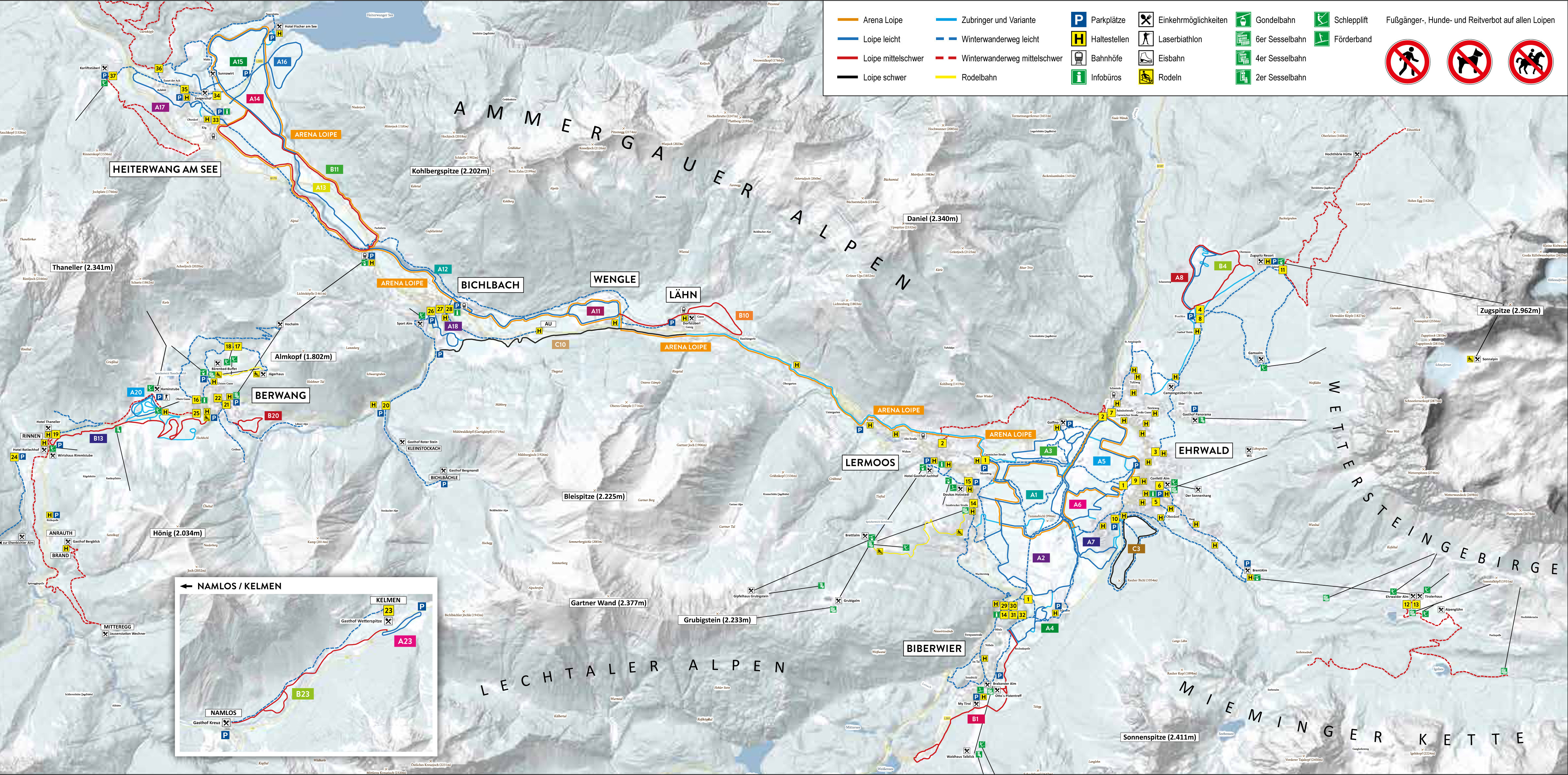
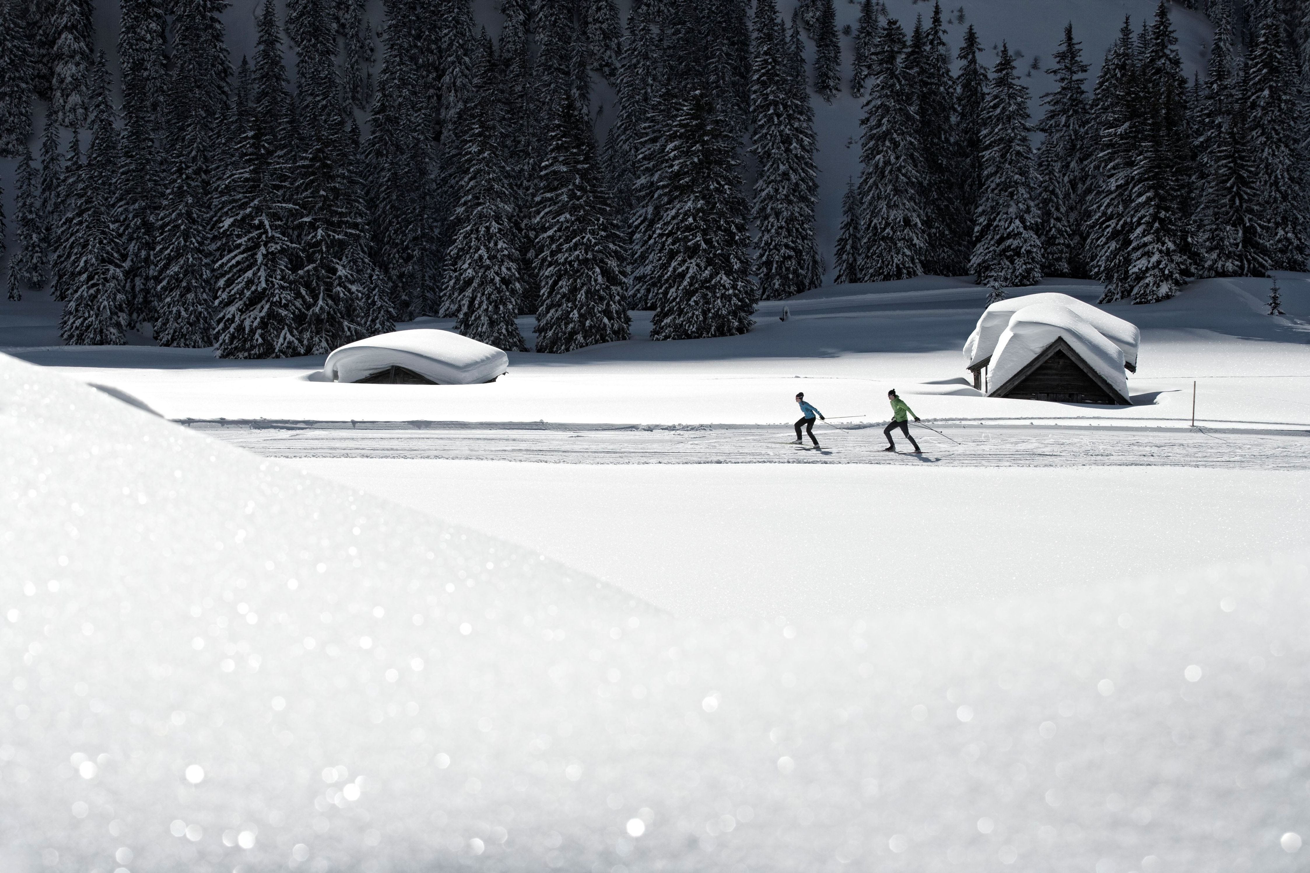
The Cross-Country Area
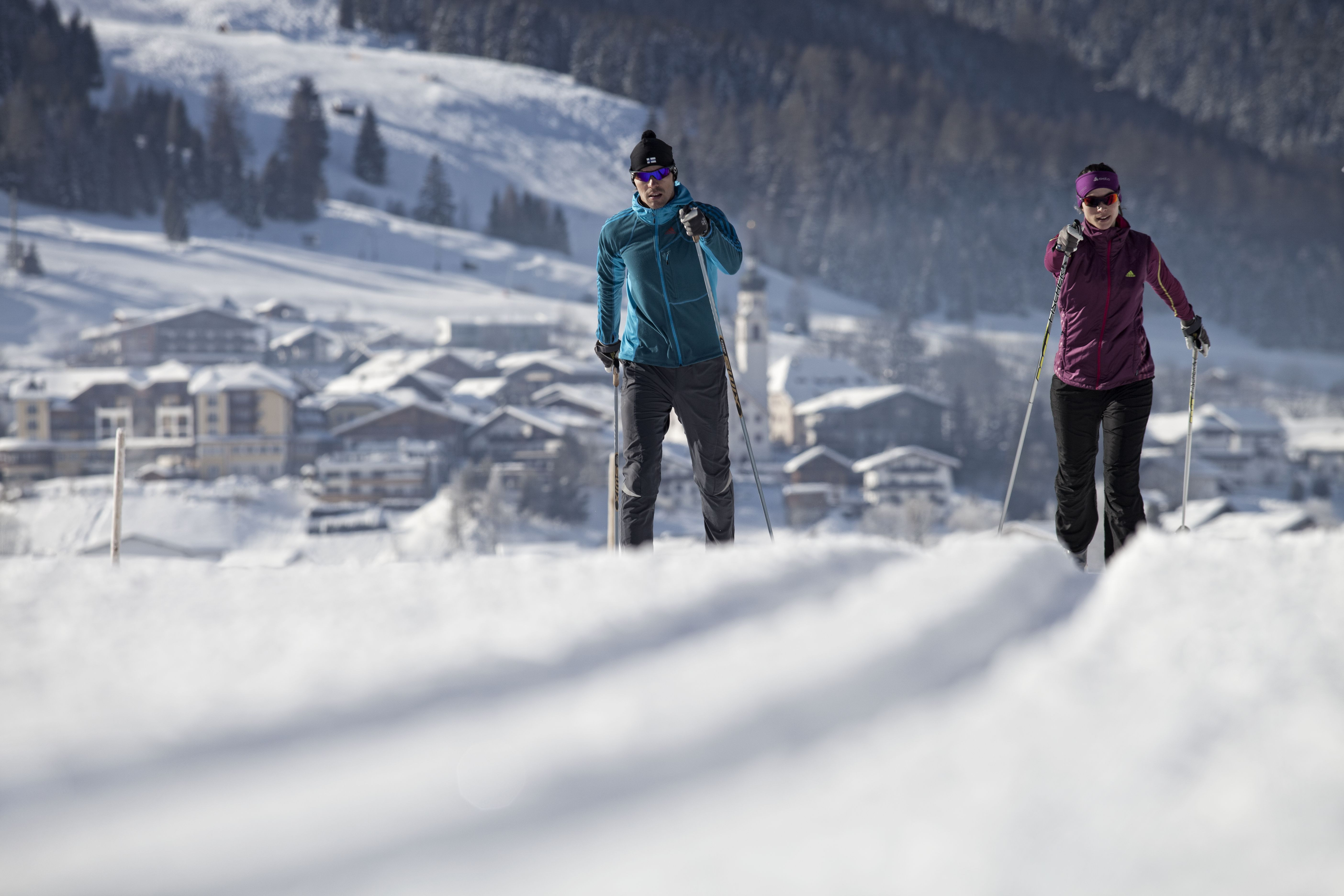
The Tiroler Zugspitzarena is a veritable Eldorado for cross-country ski fans with a network of over 110 km of trails (classic and skate skiing). The trails here are suitable for both ambitious as well as more leisure-driven skiers, and offer impressive panoramic views towards Germany’s highest mountain – the Zugspitze.
Most of the trails here are interconnected, meaning that there are plenty of entry and exit points. This also gives you the opportunity to try a different route every day, as numerous combinations are possible. If conditions aren’t ideal for returning to your base, the Zugspitz Arena Visitor Card allows you to ride the Snow Express back to your starting point for free.
The snow is likely to be excellent on the high-level trails on the Ehrwalder Alm as well as on the trails in Ponöfen in Ehrwald and Berwang, directly at the foot of the Zugspitze. The 2.5 km Golfrundloipe is also known for its snow quality. This trail starts directly by the Restaurant Golfino and leads over the golf course back to the starting point, where there are plenty of parking spaces available for skiers.
A laser biathlon is also held on a weekly basis in Berwang on the Moosloipe. Alternatively, guests who are looking to find their way in the sport can also try the trial biathlon, which includes support from staff. The introductory course and race take around three hours.
The Most Beautiful Tracks
The circular Kelmerfeld trail is short but sweet with a length of around 1.5 km. Skirting the forest in some sections, it’s relatively flat as it hugs the hillside above the Kelmerfeld road. This is not a particularly demanding course and therefore an excellent choice for beginners.
The circular Ehrwald B4 trail is a great option for intermediates. This 2.7 km trail sweeps past snowbound forests and encompasses several tricky inclines and descents.
Skiers will need immaculate technique to tackle the C3 Lärchenwald trail. This 0.5 km trail is uphill for the first 87 m before descending again. Skiers can then continue on the considerably easier but equally as beautiful A7 Rossmoos trail.
Interesting facts
- The high point of the cross-Country skiing area is located at an elevation of 1,600 m.
- Snow coverage is usually best during February, offering an average snow depth of 192 cm at summit elevation and 55 cm at the base.
Video
Dining along the Tracks
Skiers tackling the high-level Ehwalder trails should definitely make a stop in the cosy Ehrwalder Alm lodge, which is located directly by the mountain station of the Ehrwalder Almbahn lift. Visitors here are treated to delicious Tyrolean specialities like dumplings and apple strudel, and if the weather’s kind, you can even catch some rays on the generously sized sundeck.
Getting Here
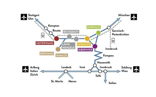
By car: You can travel from Germany toll-free via the A7 (Ulm-Füssen) and A95 (Munich-Garmisch Partenkirchen).
By public transport: Coach services like Flixbus also provide a good-value option of travelling from Munich to the Zugspitzarena (alight in Ehrwald). ÖBB rail services also stop regularly in Ehrwald.
By aircraft: The closest airports to the Zugspitzarena are in Innsbruck, Munich and Memmingen.