Webcams Warth-Schröcken
Elevation: 1,747 m
This webcam is located in the middle of the Lechtal Alps. In the picture you can see the Körbersee on the left and the Berghotel Körbersee on...
Elevation: 1,289 m
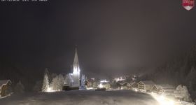
Live pictures from the small mountain village Schroecken in the Vorarlberg region with Hochkünzelspitze mountain in the background.
Elevation: 1,962 m
This webcam shows Widdersteinhütte and the surrounding mountain landscape. The ski resort of Warth-Schröcken is also discernable.
Elevation: 1,883 m
View to Warth Schröcken Ski Resort from the Wartherhorn Express chair.
Elevation: 2,024 m
This webcam shows a panorama of the top station of the Saloberjet chair lift in the ski resort Warth Schröcken.
Elevation: 1,675 m
View from the base station Salober between Warth and Schröcken.
Advertisement
Elevation: 1,589 m
Outlook at Jägeralpe alp direction Hochberg mountain, Rothorn mountain and Widderstein mountain.
Elevation: 1,608 m
View from the Jägeralpe with Biberkopf mountain (2.599m) in the background.

