
Cross-Country Weather Perisher Blue
Perisher Blue Summit
2,034 m

© GeoSphere Austria
partly light snowfall
-4 °C
min -3 °C
max 0 °C
max 0 °C
Today, 28 Jul 2026: Fair in the early morning, soon becoming hazy. Snow showers will come through in the afternoon.
Show 9 Day ForecastMorning
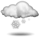 snowfall
-4 °CRain: 10 l/m2Fresh snow: 8 cmWind direction: WestWind speed: 68 km/hStorm risk: 0 %Fog risk: 80 %Rain risk: 10 %Noon
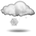
 snowfall
-6 °CRain: 4 l/m2Fresh snow: 5 cmWind direction: WestWind speed: 50 km/hStorm risk: 25 %Fog risk: 75 %Rain risk: 4 %Evening
 light snowfall
-4 °CRain: 2 l/m2Fresh snow: 2 cmWind direction: WestWind speed: 47 km/hStorm risk: 0 %Fog risk: 70 %Rain risk: 2 %