The Cross-Country Area
Around the French town of Morzine, in the Portes du Soleil winter sports area, there are four cross-country trails for all levels of ability, but experienced runners will find what they are looking for here.
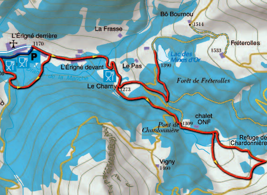
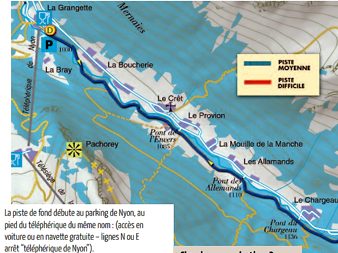
Vallée de la Manche cross-country ski trail
This trail starts at the car park of the Nyon gondola station south of Morzine and is suitable for experienced skiers up to the village of L'Erigné. Afterwards it becomes more demanding and is recommended for advanced cross-country skiers. From L'Erigné we go to Lac de Mines d'Or at an altitude of 1,390 metres and continue over the Pont de Chardonnière mountain (1309 m) to the Terres Maudites mountain range. Cross-country skiers should note that the trail has only one track and not, as usual, two parallel tracks. In addition, there is only a small space for skating.
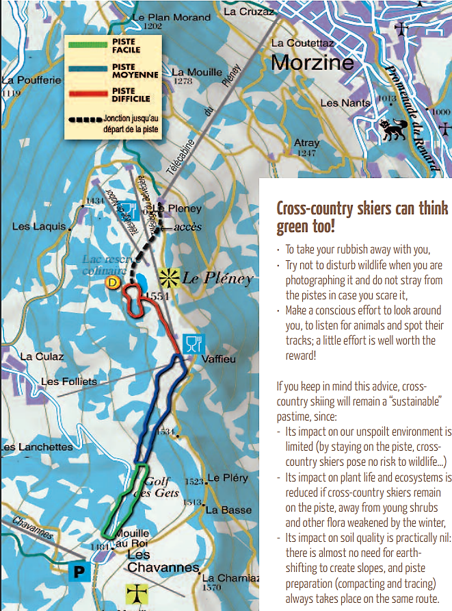
Pléney- Chavannes cross-country ski trail
The Pléney- Chavannes track is 4.5 kilometres long and is suitable for training due to its hilly terrain. To get to the start of the trail, take the Pléney gondola, which is subject to a charge. At the top station, walk to the end of the Wonder Carpet and cross the slope on the right below the Nabor chairlift. This is also the best place to strap on your skis.
The Pléney- Chavannes trail has three different levels of difficulty and is therefore suitable for both beginners and advanced skiers. The red marked part of the parallel track is only open when snow conditions are good.
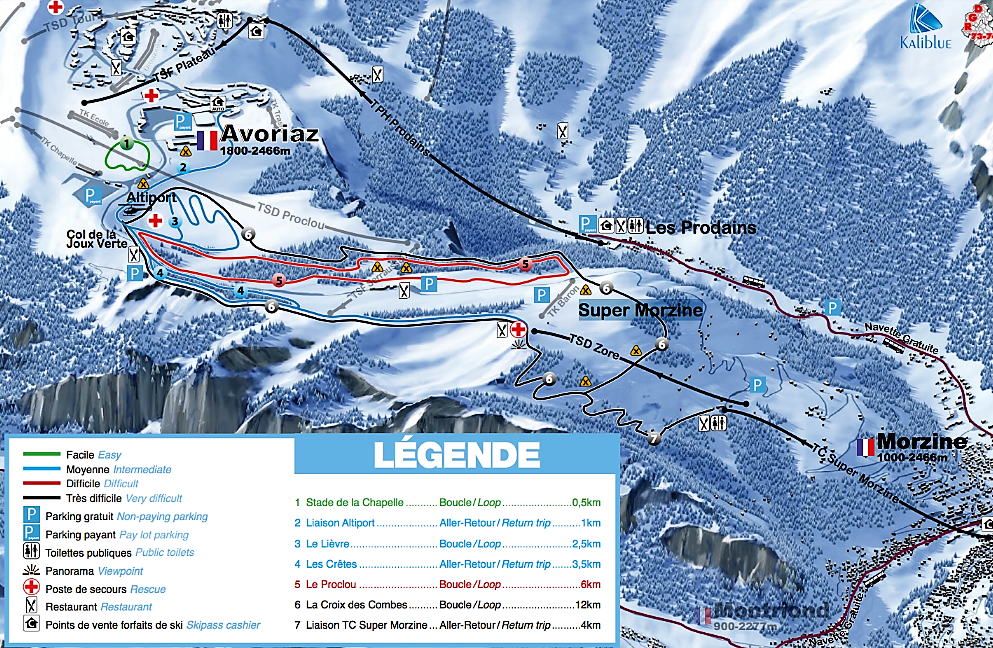
Super Morzine/Avoriaz cross-country ski trail network
The Super Morzine gondola lift transports athletes to the cross-country ski runs on the Super Morzine plateau, which is connected to the Avoriaz cross-country ski run network. The area is attractive with 16 kilometers of black marked trails mainly for experienced cross-country skiers.
The Most Beautiful Tracks
Overview of the cross-country trails in the cross-country skiing centre Avoriaz:
- Vallée de la Manche: 20 km / marked blue (medium) and red (heavy)
- Pléney- Chavannes: 5,8 km, the track has green (easy), blue (medium) and red (difficult) marked sections.
- Super Morzine:
- La Croix des Combes: round track / 12 km / black marked (very difficult)
- Liaison TC Super Morzine: 4 km / marked black (very difficult)
Interesting facts
- The cross-Country skiing area takes you to an elevation of 1,390 m.
Getting Here
By car
From Geneva you can reach Morzine in about 80 minutes via the A40 motorway. Leave the motorway at the Scionzier exit, cross the Avre river and follow the D902 via Châtillon-sur-Cluses, Taninges and Les Gets to Morzine.