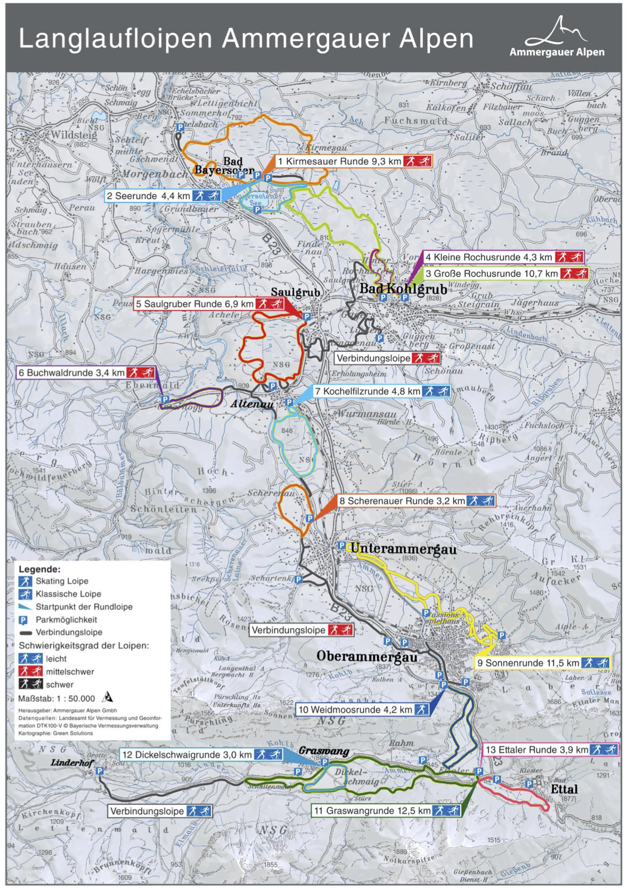
The Cross-Country Area
160 kilometres of cross-country ski trails promise pure winter sports fun. Due to its altitude, the Ammergau Alps are considered to be particularly snow-sure. Cross-country skiing is therefore generally possible here from December to mid/end of March.
13 circuits and three cross-country ski trails are available here. They are all connected with each other and reach from the Soier lake in the north to the southern castle Linderhof.
The trails have varying degrees of difficulty, so that from the comfortable powder snow trail in Oberammergau to the demanding König-Ludwig run, there is something for everyone. Almost all routes have a classic track and skating preparation.
The Most Beautiful Tracks
A clear highlight in the Ammergau Alps is the 30-kilometre-long König-Ludwig-Loipe. The medium-difficult route starts at the cemetery in Oberammergau and leads back via Graswang and Linderhof.
Interesting facts
- The high point of the cross-Country skiing area is located at an elevation of 831 m.
- Snow coverage is usually best during January, offering an average snow depth of 29 cm at summit elevation and 16 cm at the base.