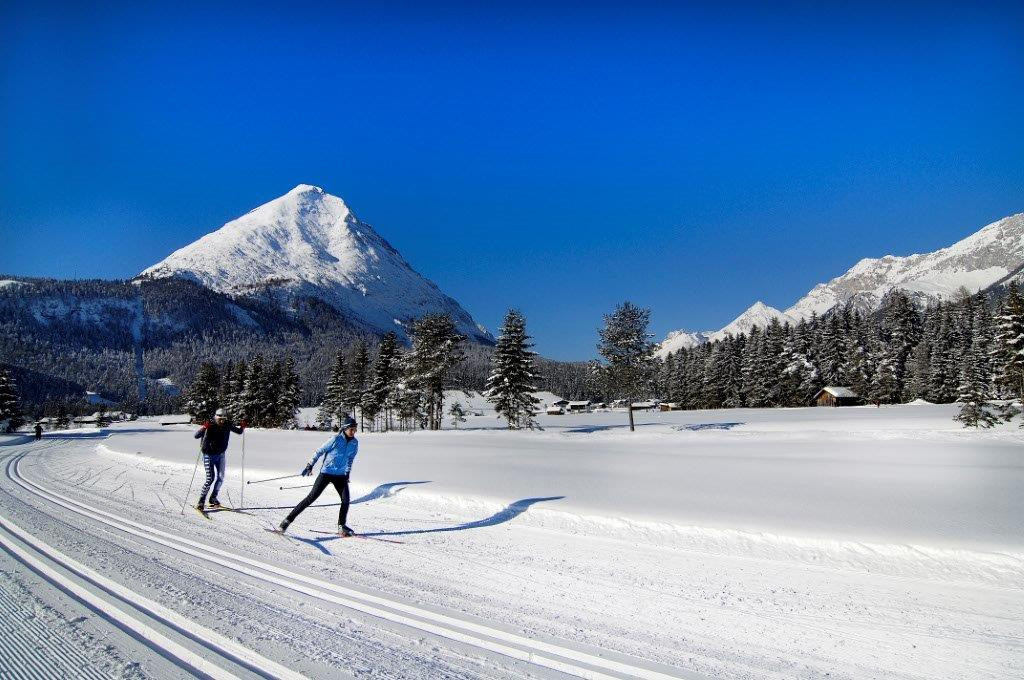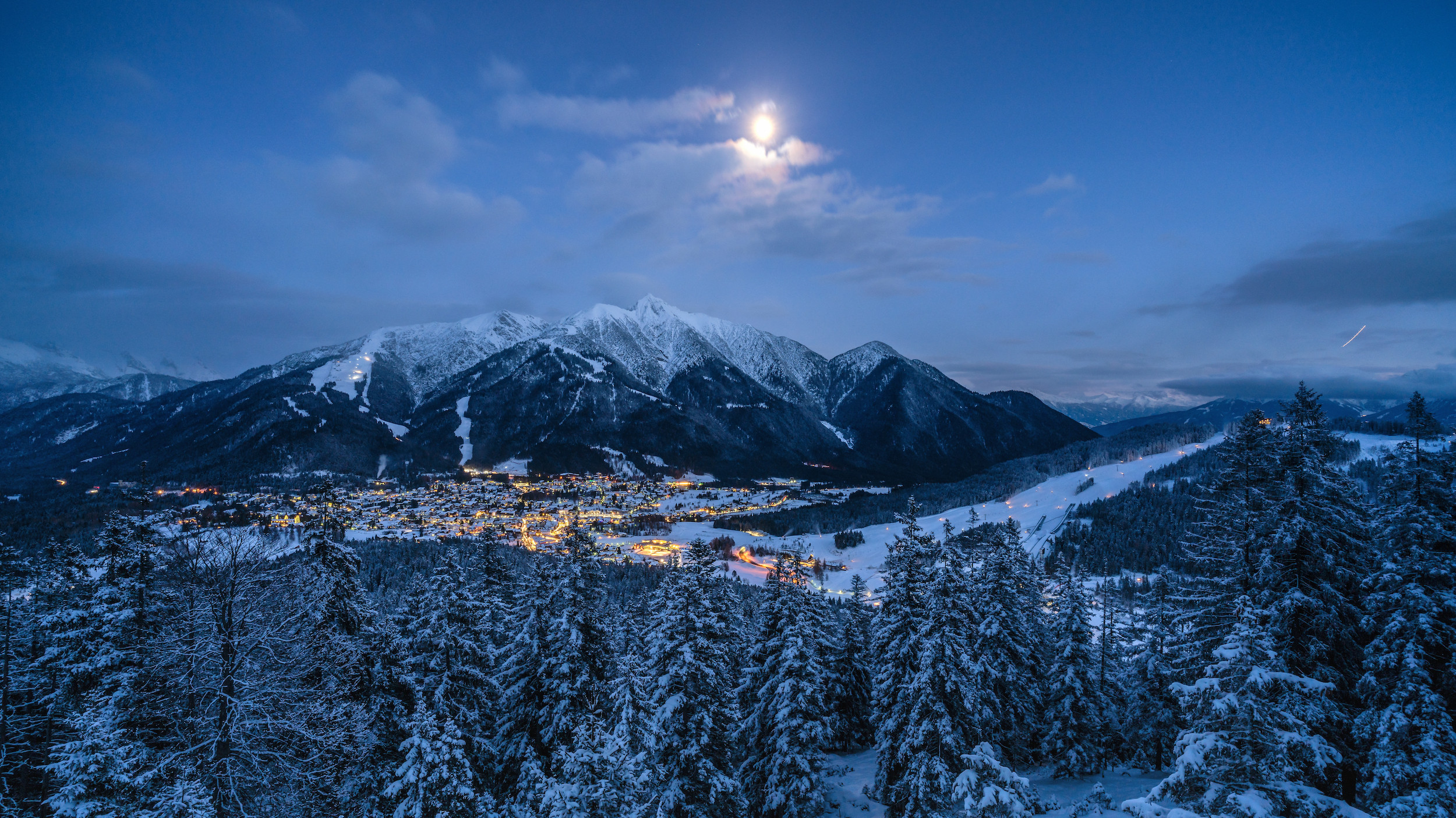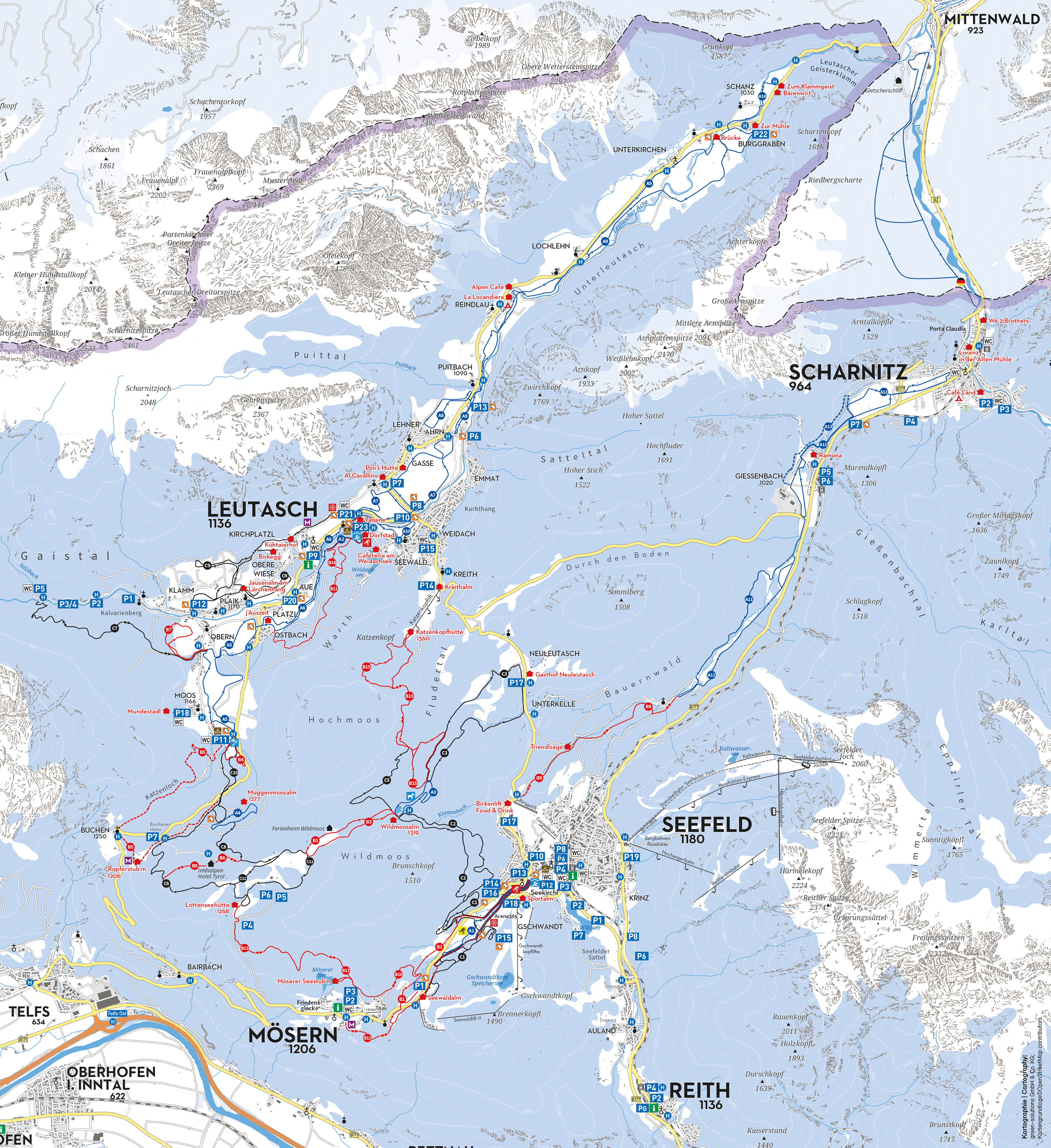
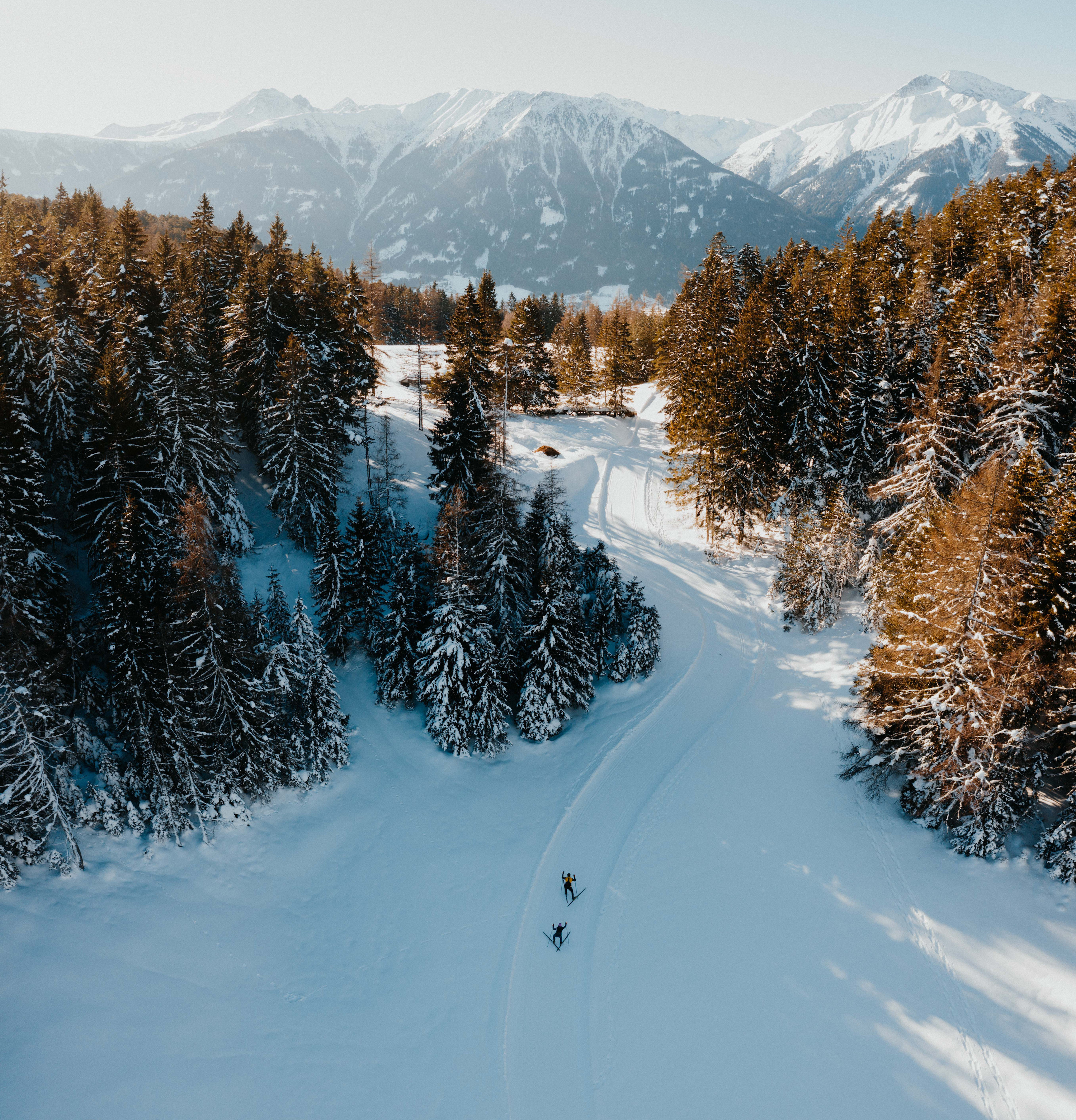
The Cross-Country Area
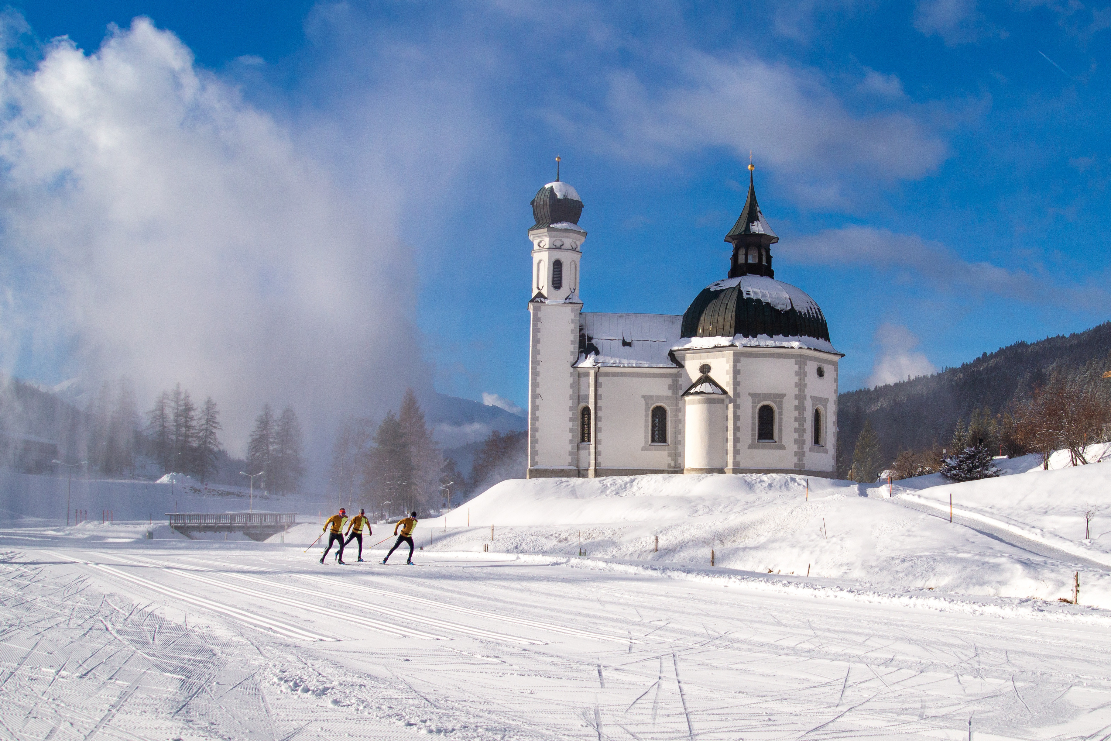
Around Seefeld in Tyrol, on a snowsafe high plateau, you can find one of Austria's largest cross-country areas. More than 256 kilometres (160 miles) of trails offer fans of Nordic skiing plenty of space to enjoy their sport. Trails go between the towns of Seefeld, Leutasch, Reith, Mösern, Buchen, and Scharnitz.
They include suitable tracks for beginners as well as more advanced skiers. Furthermore, two illuminated night trails (4 km/ 2.5 miles) and more than 44 kilometres (27.3 miles) of accessible tracks. And all of that within the beautiful backdrop of impressive mountains, idyllic woods, and traditional villages.
The Most Beautiful Tracks
- A1 Night Trail (classic & skating), start/finish Seefeld, length 3.4 km, difference in height 12 m, easy
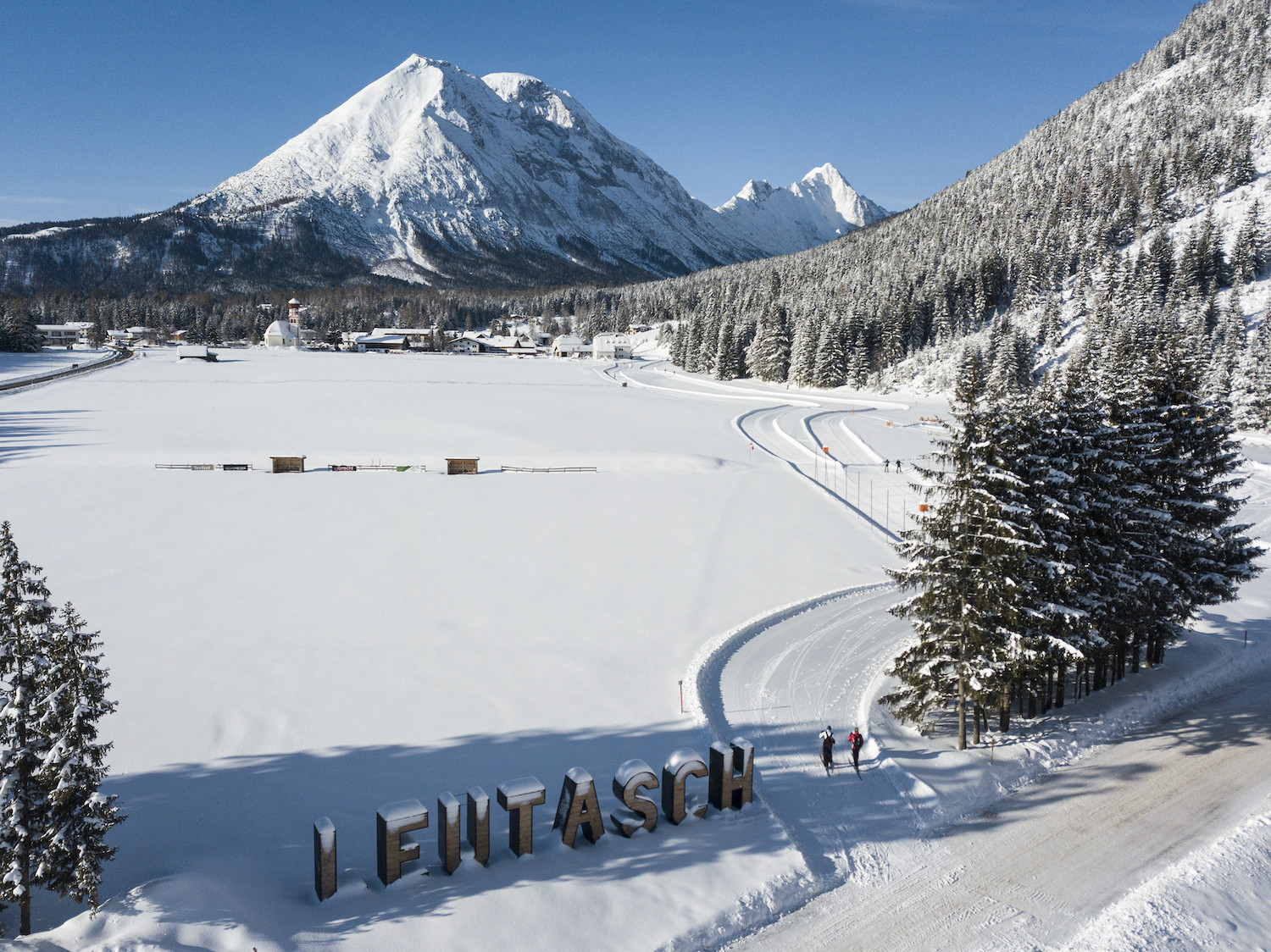
- A5 Obern (classic & skating), start/finish Leutasch – Moos; length 5.2 km; difference in height 30 m, easy
- A6 Alpenbad (classic & skating), start/finish Leutasch; length 5.6 km, difference in height 53 m; easy
- A7 Gasse (classic & skating), start/finish Leutasch – Nordic Centre; length 4.7 km, difference in height 27 m, easy
- B1 Mösern new (classic & skating), start Seekirchl Seefeld, finish Mösern, length 3.3 km, difference in height 83 m, intermediate
- B11 Waldloipe (classic & skating), start/finish Leutasch, length 3.2 km, difference in height 77 m, intermediate
- B2 Auland (classic), start/finish Seefeld, length 5.3 km, difference in height 147 m, intermediate
- B3 Lottensee new (classic & skating), start/finish Wildmoos, length 6.3 km, difference in height 147 m, intermediate
- B4 Skatingzentrum (classic & skating), start/finish Leutasch, length 1.2 km, difference in height 42 m, intermediate
- C2 Wildmoos (classic & skating), start/finish Seefeld, length 4.9 km, difference in height 145 m, difficult
You can find an interactive trail map on the official website of Olympiaregion Seefeld.
Interesting facts
- Offering 245 km cross-country trails, Region Seefeld is among the 3 largest Cross-Country Skiing Areas in Austria.
- Region Seefeld is among the 5 best rated Cross-Country Skiing Areas in Tyrol.
- The highest point of the track is 1,560 m above sea level.
- Snow coverage is usually best during February, offering an average snow depth of 88 cm at summit elevation and 35 cm at the base.
Videos
Dining along the Tracks
Along the tracks of the Seefeld region, 46 traditional dining facilities take care of your every culinary need. Typical Tyrolean fare such as dumplings, cheese spaetzle, and Kaiserschmarrn help fuel your next laps around the tracks. Or you call it a day, and simply sit down and relax in the sun for a bit ...
Getting Here
By car
Getting to Seefeld in Tyrol is easy from all directions.
North: Munich - Garmisch-Patenkirchen - Mittenwald - Seefeld
East: Salzburg - Innsbruck - exit Zirl over Zirler Berg
South: Brenner (A13) - Innsbruck - exit Zirl over Zirler Berg
West: Kempten - Füssen - Reutte - Fernpaß - Imst - exit Telfs Ost - Seefeld
By train
If you don't want to drive, getting a train could be an easy and comfortable alternative. Seefeld is connected to Munich as well as Innsbruck via rails. The train station is located conveniently at the edge of the main pedestrian area. Reith and Scharnitz also have train stations.
By bus
Travelling by bus is another easy and cheap option. Flixbus goes from Seefeld to Munich and back 8 times every day. There are also bus connections to and from Italy or Switzerland.
If you have your trail ticket, regional busses take you into the cross-country area free of charge. Within Seefeld, shuttle services are available for free as well. You can even go between Innsbruck - Seefeld - Scharnitz and back by train for free.