
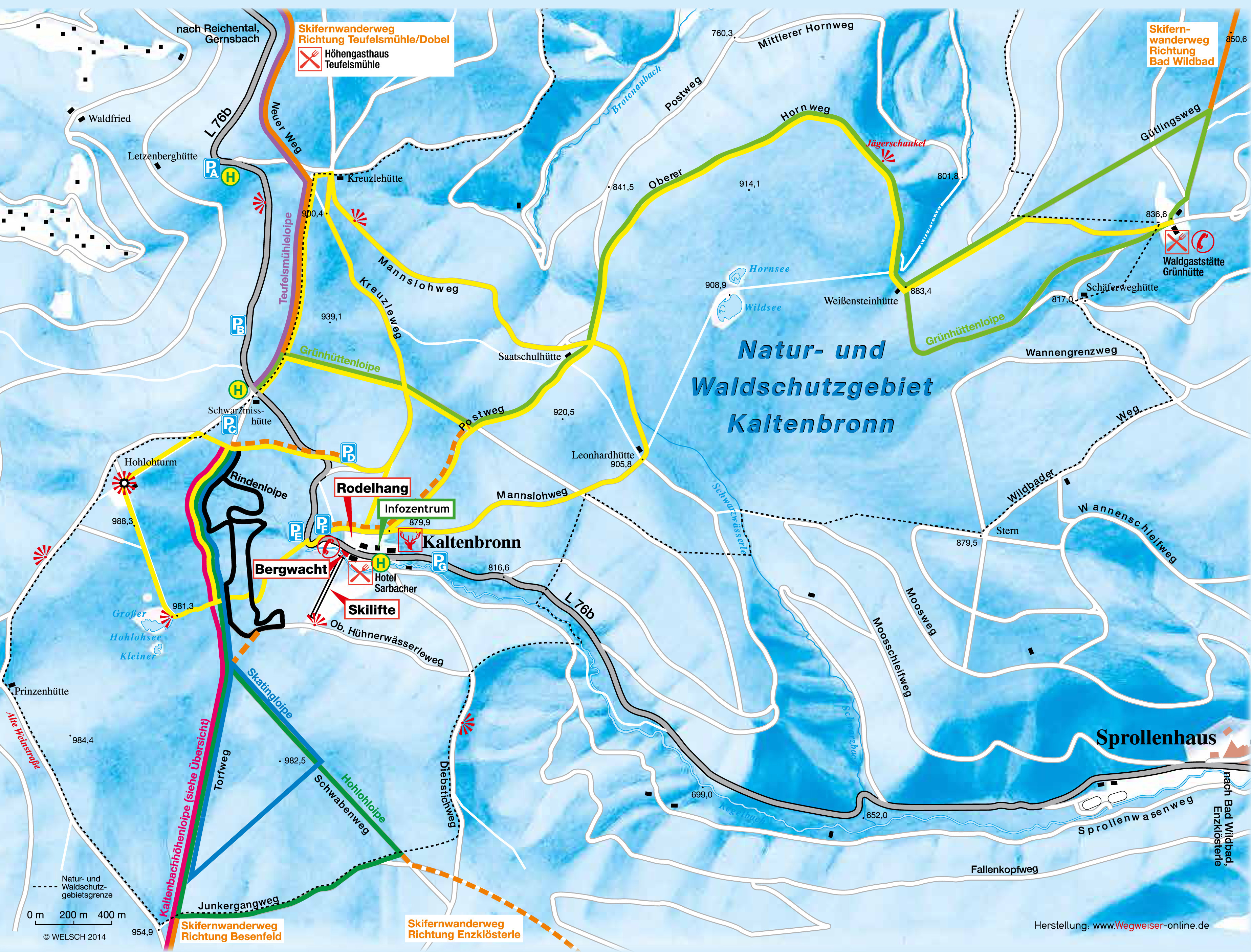
The Cross-Country Area
Kaltenbronn in the northern Black Forest has a network of 65 kilometres of cross-country trails at your disposal. Whether beginner or professional, whether classic cross-country skiing or skating, there is something for everyone here. The laps have a length of 3 to 22 kilometers. The starting point for all six round trails is car park C at the Schwarzmiss Hütte am Kaltenbronn. Via long-distance ski trails there is also a connection to the Dobel, Bad Wildbad, Talwiese, Enzklösterle and Besenfeld round trails.
The Most Beautiful Tracks
Hohloh cross-country ski run: 6.4 km - easy - classic/skating
Skating track: 5,2km - easy - classic/skating
Green hut cross-country ski run: 16 km - medium - classic/skating
Kaltenbach-Höhenloipe: 21.5 km - medium - classic/skating
Bark track: 3.3 km - difficult - classic/skating
Teufelsmühleloipe: 12,3 km - difficult - classic
Interesting facts
- The highest point of the track is 937 m above sea level.
- Snow coverage is usually best during November, offering an average snow depth of 20 cm at summit elevation and 13 cm at the base.
Getting Here
From Rastatt follow the B462 to Hilpertsau. There you turn left and drive via Reichental towards Kaltenbronn. The trails start at the Schwarzmiss hut, where you will find parking lot C.
The Schwarzmiss hut is also served by bus line 242.


