The Cross-Country Area
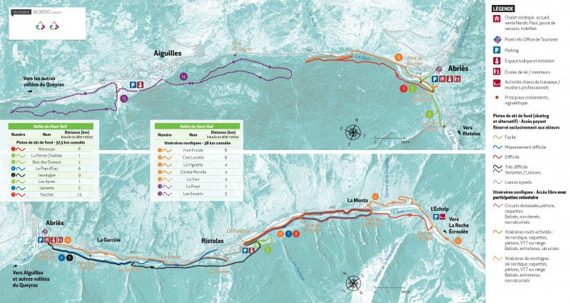
A total of over 37 kilometres of trails await you in the Vallée du Haut-Guil on the French-Italian border. The eight trails are distributed between the villages of Aiguilles, Abriès and Ristolas.
Interesting facts
- Offering 37.50 km cross-country trails, Abriès - Aiguilles - Ristolas (Vallée du Haut-Guil) is among the 3 largest Cross-Country Skiing Areas in Provence-Alpes-Côte d’Azur.
- The highest point of the track is 1,613 m above sea level.
- During the season the average snow depth at Abriès - Aiguilles - Ristolas (Vallée du Haut-Guil) is 68 cm. Snow coverage is usually best during March, offering an average base depth of 110 cm.
- Abriès - Aiguilles - Ristolas (Vallée du Haut-Guil) features 54 sunny days on average per season. The average for all cross-Country Skiing Areas in France is 50 sunny days. March is the sunniest month with an average of 18 sunny days. This makes the cross-Country skiing area one of the 10 sunniest in France.