Cross Country Skiing Weather France
Rhône-Alpes
500 m: up to 35 °C
| 1,000 m: up to 35 °C
| 2,000 m: up to 23 °C
A mix of sun and cloud is in store in the forenoon for the north today. The forenoon is mostly cloudy, refreshed with some occasional rain in the night. Sunny skies team up with temperatures of 35 °C today in the south. Today is a perfect day in the east to enjoy some sweet sunshine with a high near 36 °C. A mix of sun and cloud is in store in the forenoon for the west today. The day will be partly cloudy with sunny intervals. There is a gentle breeze blowing from the south.
| Today | Tomorrow | Saturday | Sunday |
|---|---|---|---|
34 °C | 32 °C | 33 °C | 35 °C |
Provence-Alpes-Côte d’Azur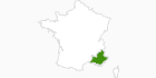
500 m: up to 32 °C
| 1,000 m: up to 31 °C
| 2,000 m: up to 24 °C
Today is a perfect day in the north, south, west and east to enjoy some sweet sunshine with a high near 30 °C. A light southwest breeze brings along balmy temperatures.
| Today | Tomorrow | Saturday | Sunday |
|---|---|---|---|
32 °C | 32 °C | 32 °C | 32 °C |
Travel Deals & Tips
Advertisement
Advertisement
Franche-Comté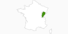
500 m: up to 35 °C
| 1,000 m: up to 33 °C
The north, south, west and east is expected to be able to enjoy a wonderful day full of sunshine. A mix of sun and cloud is in store in the forenoon for today. Temperatures are not far from normal, but the breeze from the west keeps it from feeling as warm as it could if there were no wind.
| Today | Tomorrow | Saturday | Sunday |
|---|---|---|---|
36 °C | 30 °C | 32 °C | 35 °C |
Lorraine
500 m: up to 35 °C
| 1,000 m: up to 30 °C
In the north, forecasters are predicting sunshine in the morning with a chance of rain in the noon. Scattered showers are expected to give way to some clouds in the evening. The south is expected to be able to enjoy a wonderful day full of sunshine. A mix of sun and cloud is in store in the forenoon for today. The east is expected to be able to enjoy a wonderful day full of sunshine. A mix of sun and cloud is in store in the forenoon for today. In the west, forecasters are predicting sunshine in the morning with a chance of rain in the noon. Scattered showers are expected to give way to some clouds in the evening. Temperatures are not far from normal, but the breeze from the west keeps it from feeling as warm as it could if there were no wind.
| Today | Tomorrow | Saturday | Sunday |
|---|---|---|---|
34 °C | 30 °C | 30 °C | 33 °C |
Auvergne
500 m: up to 33 °C
| 1,000 m: up to 33 °C
| 2,000 m: up to 22 °C
A mix of sun and cloud is in store in the forenoon for the north today. The forenoon is mostly cloudy, refreshed with some occasional rain in the night. A mix of sun and cloud is in store in the forenoon for the south today. The day will be partly cloudy with sunny intervals. The east is expected to be able to enjoy a wonderful day full of sunshine. Forecasters are predicting sunshine in the noon with a chance of rain in the evening. A mix of sun and cloud is in store in the forenoon for the west today. The day will be partly cloudy with sunny intervals. Temperatures are not far from normal, but the breeze from the south keeps it from feeling as warm as it could if there were no wind.
| Today | Tomorrow | Saturday | Sunday |
|---|---|---|---|
34 °C | 31 °C | 32 °C | 35 °C |