+
+
Ski Resort Val Louron in the Pyrenees: Position on map

Val Louron Ski Resort

Trail Map Val Louron

Interesting facts

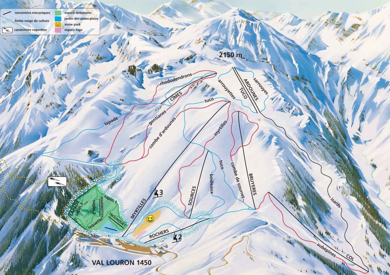
  • The vertical drop from summit to base is 650 m. The average difference in altitude between base and summit of Ski Resorts in France is 819 m. The highest point of the track is 2,100 m above sea level.

Snow Safety & Snowmaking

Snow Making Machines: 50

Infrastructure & Rental

About the author
last update on 14 Nov 2023
Rate the Ski Resort
0
(0)

Contact

Office du Tourisme Bordères Louron
Maison de la Vallée
65590
Bordères Louron
E-Mail
Email%69%6e%66%6f%40%76%61%6c%6c%65%65%2d%64%75%2d%6c%6f%75%72%6f%6e%2e%63%6f%6d
Phone+33 (0)5 62 99 92 00
Fax+33 (0)5 62 99 92 09

Comments

Rate the Ski Resort
Advertisement

Mountain Stats

Elevation1,450 m - 2,100 m
Capacity 8355 Persons/Hr.

Lifts

9
6
3
Total 9

Skiable Terrain

14.8 km
Beginner
Easy
Moderate
Advanced
Overall Slope Length 14.8 km

Webcams

Unfortunately, there is no webcam available yet!

Rates

€33.30
1 day adult €33.30
1 day youth €25.30
All rates & fees