+
+
Ski Resort Roubion in Alpes-Maritimes: Position on map

Roubion Ski Resort

Trail Map Roubion

Interesting facts

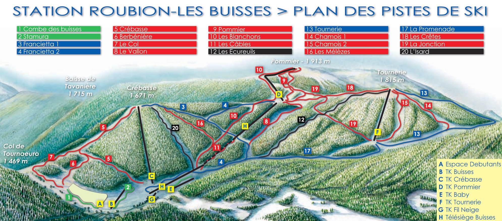
  • The vertical drop from summit to base is 520 m. The average difference in altitude between base and summit of Ski Resorts in France is 819 m. The high point of the ski resort is located at an elevation of 1,920 m.
  • The day pass at Roubion is €20 making it one of the 3 cheapest ski Resorts in Provence-Alpes-Côte d’Azur.
About the author
last update on 8 Jan 2024
Rate the Ski Resort
1
(0)

Contact

Bureau de tourisme
06420
Roubion
E-Mail
Email%74%6f%75%72%69%73%6d%65%40%72%6f%75%62%69%6f%6e%2e%63%6f%6d
Phone+33 (0)4 93 02 10 30

Comments

Rate the Ski Resort
Advertisement

Mountain Stats

Elevation1,400 m - 1,920 m
Opening Day27 Dec 2023
Closing Day10 Mar 2024
Capacity 5555 Persons/Hr.

Lifts

8
6
1
1
Total 8

Skiable Terrain

27 km
Beginner
Easy
Moderate
Advanced
Overall Slope Length 27 km

Webcams

Unfortunately, there is no webcam available yet!

Rates

€20
1 day adult €20
1 day child €15
All rates & fees