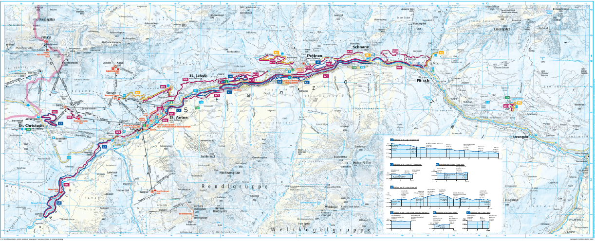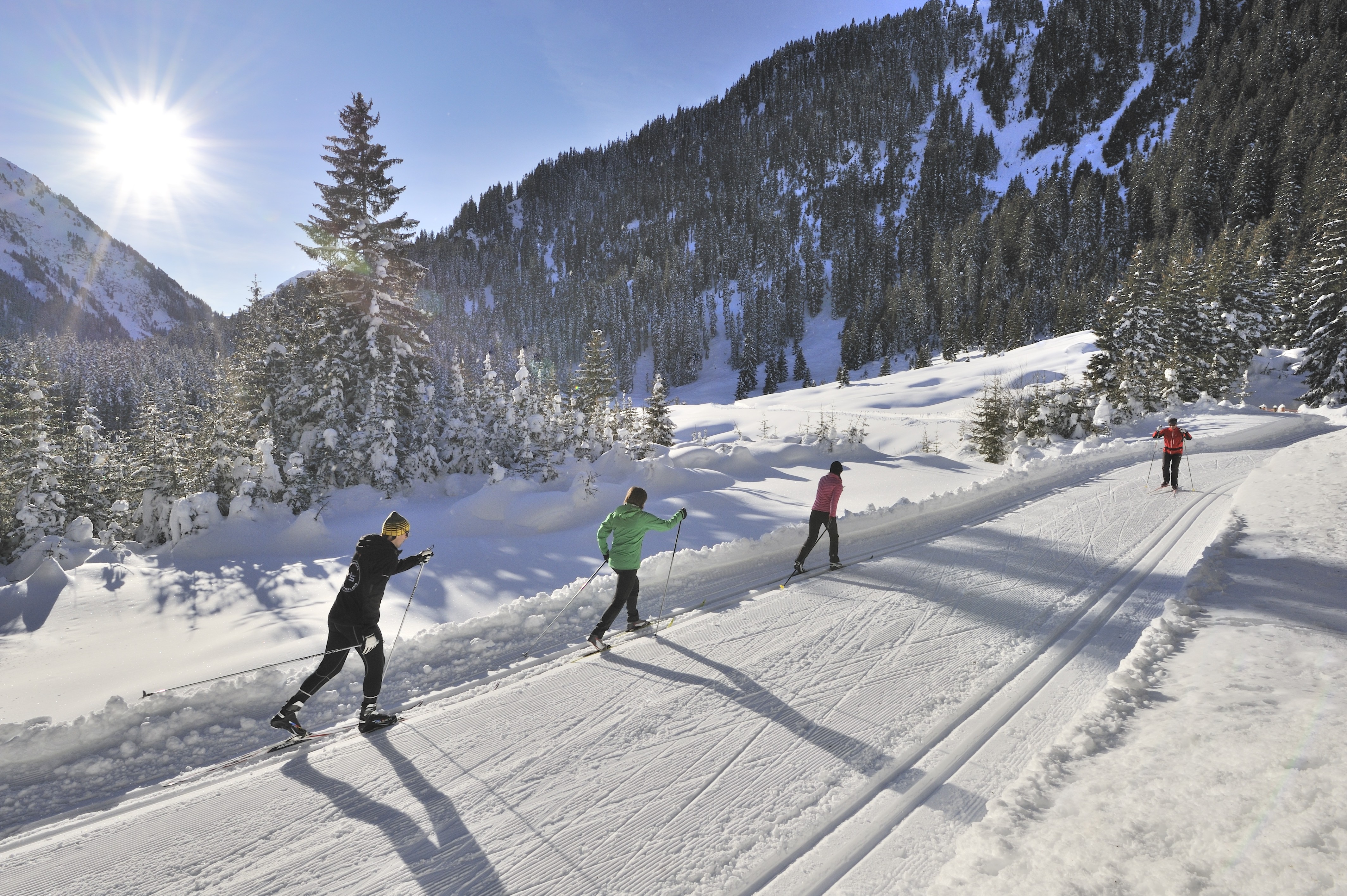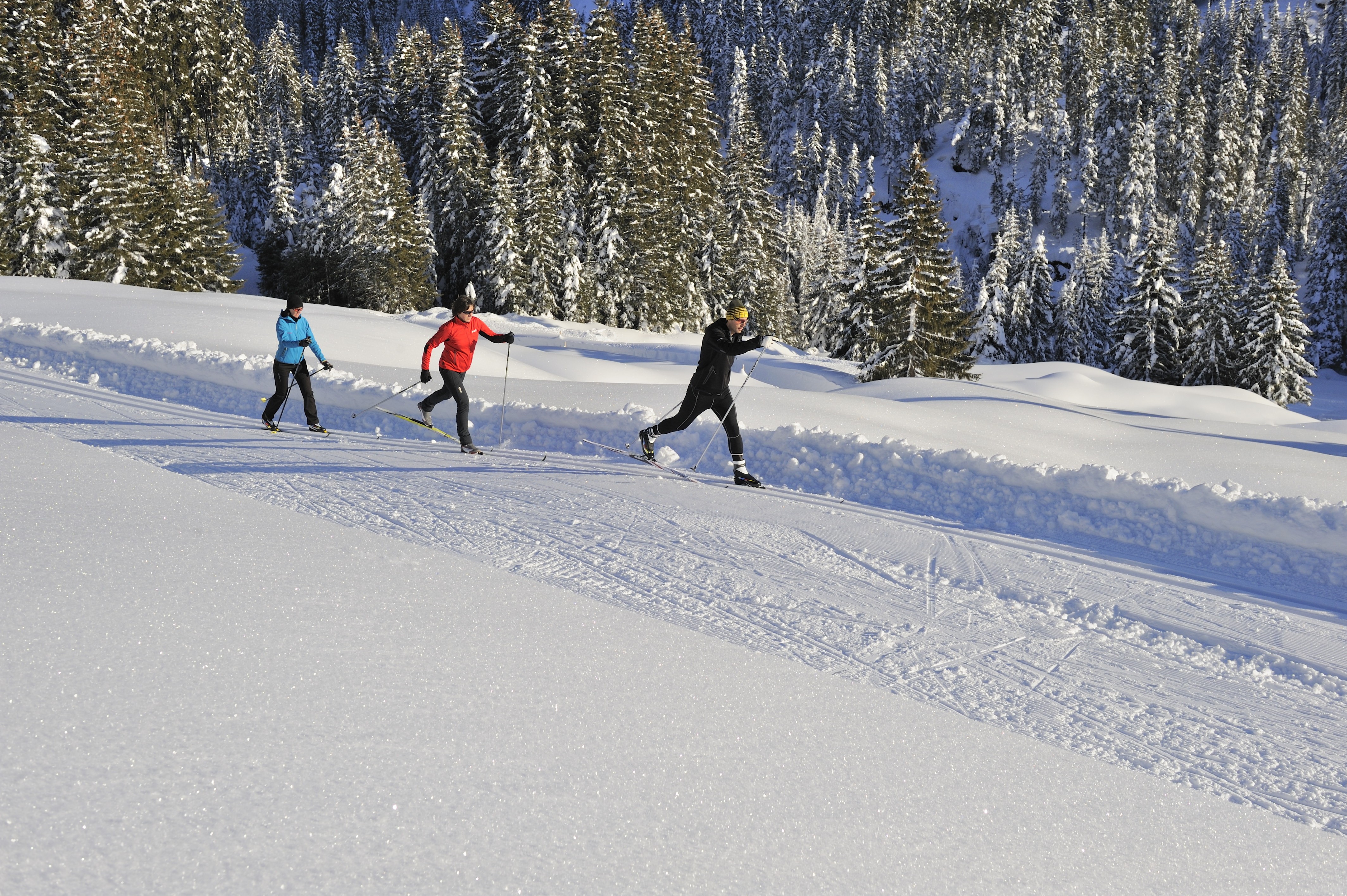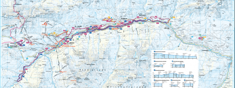
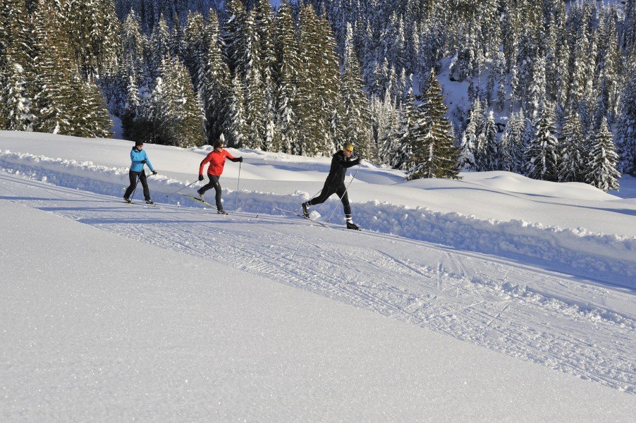
The Cross-Country Area

At St Anton am Arlberg, cross-country skiers encounter about 40 kilometres (24.9 miles) of trails. Thanks to its high snowsafety, good signage as well as the number and diversity of the tracks, they have been granted a special Tyrolean quality seal. Numerous pleasurable, but also challenging options make for a diverse cross-country experience. Apart from the first two kilometres of the Stanzertal trail, all of the trails have double tracks, and can be used for skating as well as classic cross-country skiing.
The Most Beautiful Tracks
Reit trail (easy)
The two kilometre (1.2 miles) long Reit trail east of Pettneu is a great place to start out. The easy, plane circuit is connected to Stanzertal trail.
Ganderau trail (easy)
Ganderau trail starts east of Hotel Tirolerhof (alternatively at St. Jakob fire station), and is three kilometres (1.9 miles) long. The short circuit lacks difficult slopes, hence it makes an ideal track for beginners and untrained skiers. If you want to extend the route, use the connection to Stanzertal trail. Dogs are allowed at Ganderau trail, so you can take your four-legged friend skiing with you.
Stanzertal trail (easy)
If you want to ski a longer route, Stanzertal is the trail for you. Starting at St. Anton's recycling depot, it goes along river Rosanna, all the time sloping slightly. Over its course of 22 kilometres (13.7 miles), you come past the towns of Pettneu, Schnann, and Flirsch, which can serve as alternative starting points.
High trail St. Christoph (intermediate)
The 2.5 kilometre (1.6 miles) high trail St. Christoph promises pure cross-country pleasure, especially in good weather. At an elevation of 1,800 metres (5,905 ft), this circuit leads experienced skiers through the stunning nature towards St. Christoph am Arlberg's sun plateau.
Verwall trail (intermediate)
The scenic trail of Verwall is another highlight. The demanding 10 kilometre (6.2 miles) route starts at St. Anton am Arlberg's upper village, and brings you into the indyllic Verwall valley. There are several up and downhill slopes on the way.
Pofel trail (easy)
St. Anton am Arlberg's trail network is completed by the 1.5 kilometre (0.9 miles) Pofel trail in Pettneu. Twice a week, the circuit is floodlit for night skiing. The track starts at the spa, and is open to cross-country skiers until 20:30 on those days.
Interesting facts
- Elevated between 1,300 m and 1,800 m, the Cross-Country Skiing Area is among the 10 highest elevated Cross-Country Skiing Areas in Tyrol.
- Snow coverage is usually best during March, offering an average snow depth of 287 cm at summit elevation and 76 cm at the base. Therefore St Anton am Arlberg is among the 10 cross-Country Skiing Areas with best snow conditions in Tyrol.
Video
Getting Here
By car
Coming from Innsbruck, you leave the Inntal motorway A12 in Landeck, and follow S16 (Arlberg clearway) until St. Anton. Coming from Bludenz, you can get to St. Anton am Arlberg straight over S16.
On public transport
If you're travelling by train, you can go straight to St. Anton am Arlberg. The closest airport is Innsbruck, at a distance of approximately 100 kilometres (62.1 miles).